GPS-Maps&Doc

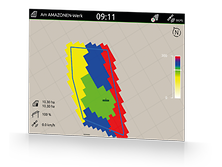
All standard ISOBUS terminals from AMAZONE can collect and save machine and site-specific data using Task Controller. Part-area, site-specific operation via the processing of application maps in a Shape file format and ISO-XML format is also possible.

  • Easy creation, loading and processing of jobs
  • Start a new task straight away and decide later whether the data is saved or not
  • Import and export of jobs in the ISO-XML format
  • Job summary via PDF export
  • Intuitive system for processing application maps in the Shape file format and ISO-XML format
  • Automatic part-area, site specific regulation of the application rate
  • Indication of inactive field boundaries and automatic field detection when approaching the area
  • Optimum crop management via needs-based application
  • Standard with AmaTron 4 and AmaPad 2

GPS-Maps&Doc

GPS-Maps&Doc offers field-related and geo-referenced documentation via Task Controller. Scheduled ISO-XML jobs can be processed or created via Task Controller. You can start working straight away and decide later whether the data should be saved or not. Application maps can be processed in the ISO-XML or Shape file format.

GPS-Switch

With GPS-Switch automatic part-width section control, AMAZONE can offer GPS-based, fully automatic part-width section control for all AMAZONE operator terminals and ISOBUS-compatible fertiliser spreaders, crop protection sprayers and seed drills.

GPS-Track

The GPS-Track parallel driving aid proves to be an enormous help in orientation within the field, especially on grassland. It features both A-B line and contour line driving track modes. The wheelings are clearly numbered. The deviation from the optimum track is shown graphically in the display.

AmaCam

Thanks to the AmaCam software licence, the optionally installed reversing camera automatically switches on when reversing. This dispenses with laborious switching and helps avoid dangerous situations behind the machine.