The soil leads to success
SoilDetect for AMAZONE cultivators generates small-area maps of the field
As part of the BMLEH's Soil4Climate joint project, AMAZONE is working with partners FieldExpert GmbH, exatrek GmbH, Osnabrück University of Applied Sciences and the JKI, plus the associated companies Westrup-Koch and Brunotte, on a system for recording soil conductivity during soil tillage. The project was initiated by the Lukas and Dr Joachim Brunotte practice, funded by the BMLEH and successfully trialled at two locations in northern Germany.
In general, intelligent soil tillage implements already offer the possibility of collecting useful data via sensor systems during the tillage operation. This data can be used during the actual work process, for pre-planning, in real time or downstream, to adjust various parameters such as working depth, working speed, slip and overload. Some of this data can also be used for mapping and additional tasks. To derive yield potential, there are few systems available today that can record the soil type and condition during soil tillage. However, if you want to detect easily the type and condition of your soil and use the data to optimise subsequent work processes and the use of resources, the SoilDetect system is the perfect tool.
Multi-sensor technology as the basis for the SoilDetect system
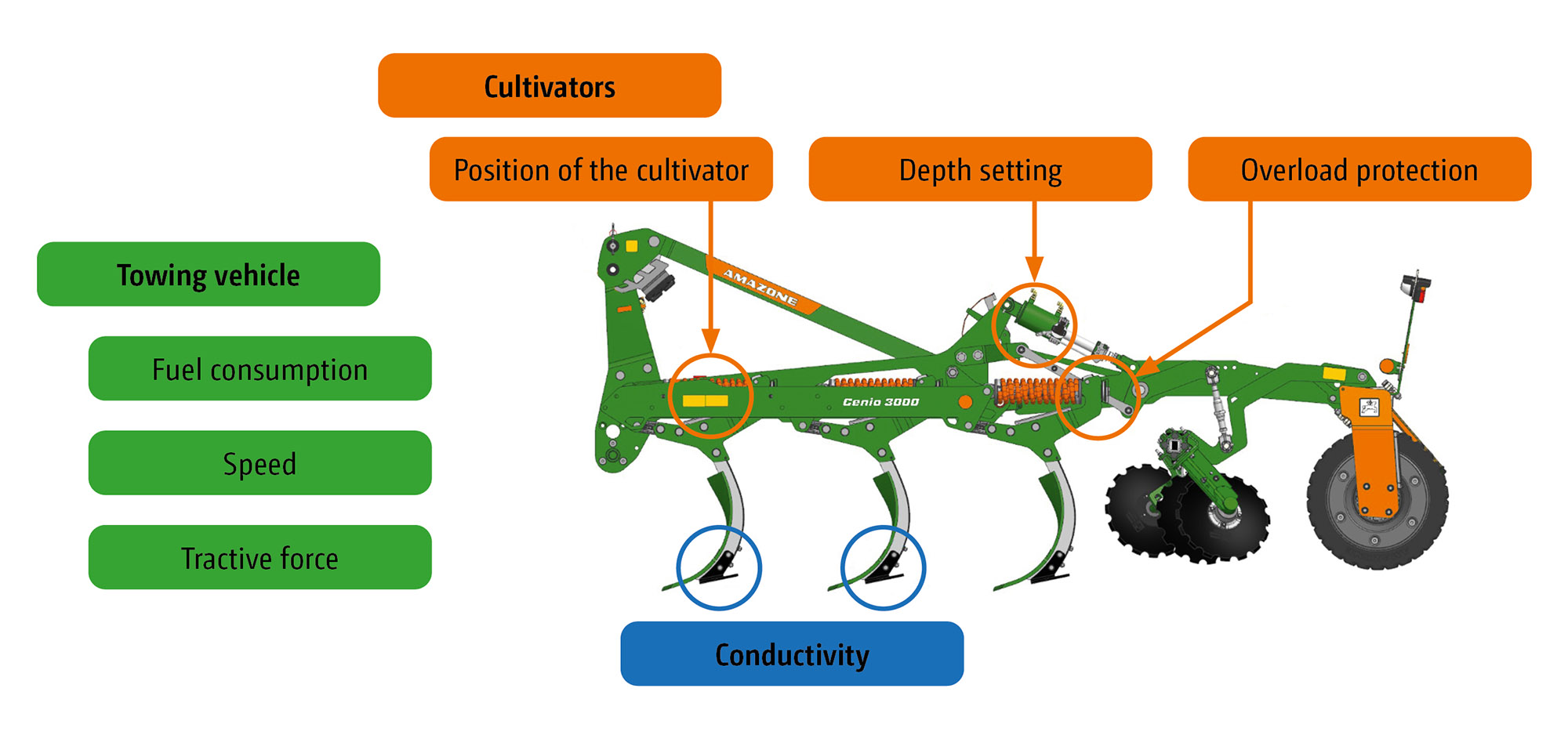
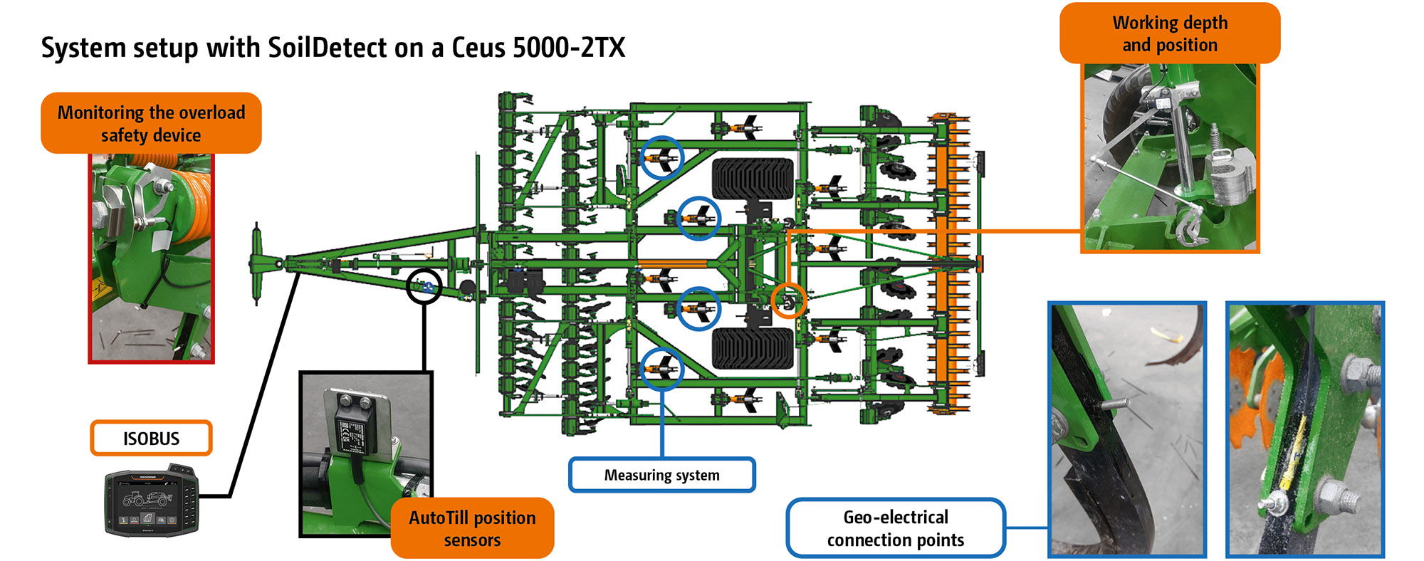
The AutoTill system (new at Agritechnica 2023) includes various sensor systems for the main segments and processes within the cultivator. In addition to the cultivator's sensor systems, the towing vehicle also provides data such as the speed, fuel consumption, slip and tractive force. The interaction and communication between the tractor and implement takes place via the ISOBUS interface. With AutoTill, collecting, analysing and using data focuses directly on the work process. During soil tillage with the cultivator in the field, however, even more data can be recorded and collected, which can then support and optimise downstream working. For example, AutoTill provides the sensor systems for SoilDetect, which focuses primarily on geo-electric soil conductivity measurement during operation. The geo-electrics are being developed by project partner Field-Expert GmbH. The data is analysed using AI methods by the project partner Osnabrück University of Applied Sciences.
Geo-electric measurement takes place during soil tillage and requires no additional resources. The generation of a high-resolution soil map is automated with the help of an expert system with AI support. The time and effort required for generation is significantly reduced, a decisive advantage over current methods.
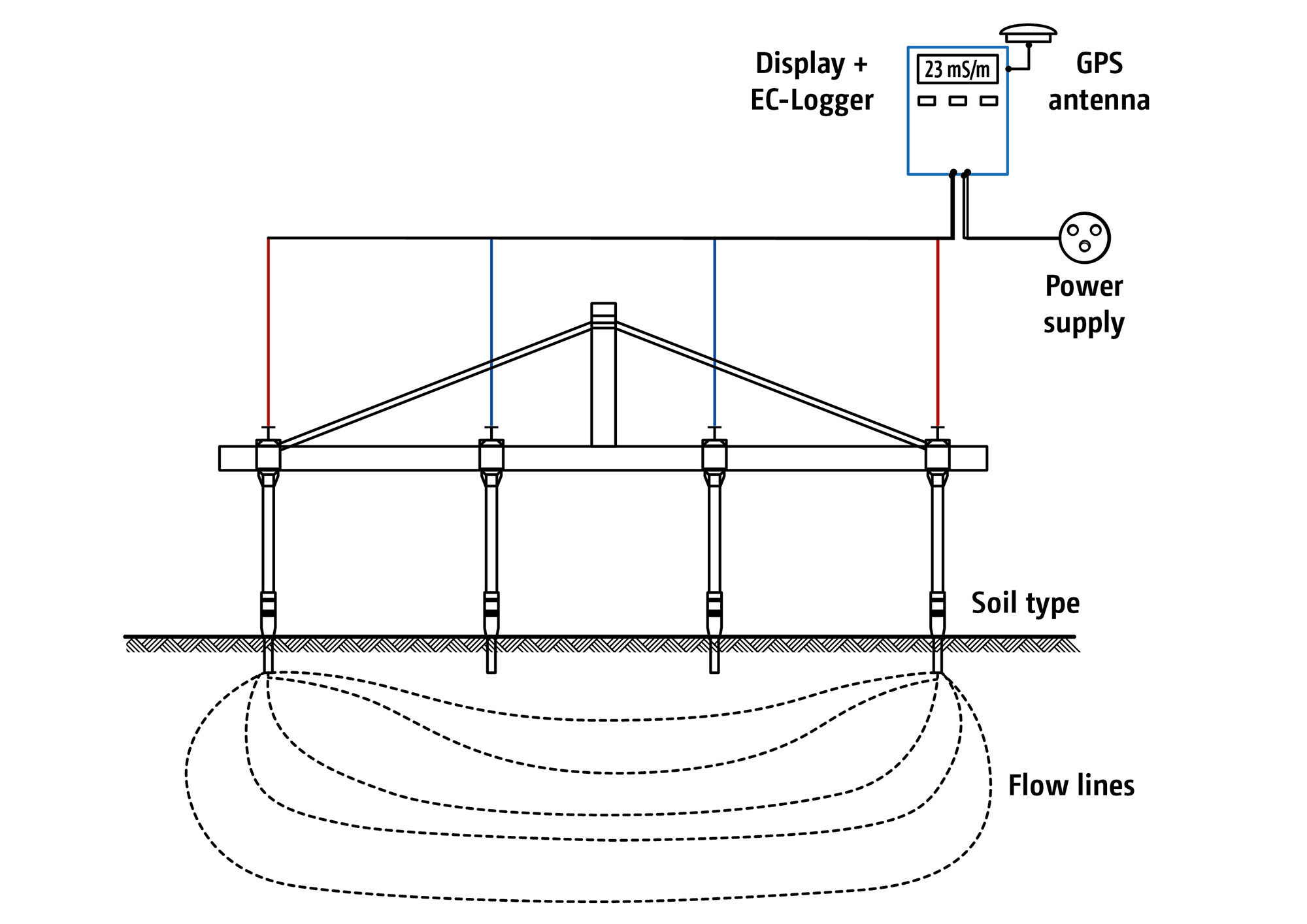
The SoilDetect system combines individual AutoTill sensor systems, such as the working depth sensor, overload safety device and position sensor, with geo-electric soil conductivity measurement. To this end, an electric current is directed into the soil via individual tines. The 4-point arrangement is used. Two pairs of electrodes are used for this purpose.
- 1 pair of electrodes (A&B) for the supply (supply electrode pair) of a constant current (I)
- 1 pair of electrodes for measuring the voltage (U)(measuring electrode pair M&N)
The measuring current (I) is constant. The measuring voltage (U) is measured. Changes in the measured voltage indicate a change in soil conductivity.
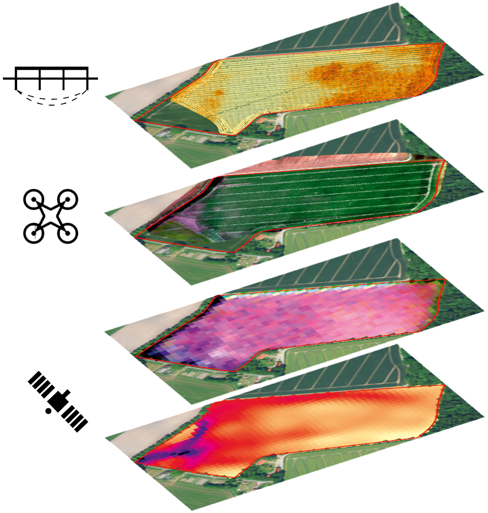
The aim of these measurements by SoilDetect during the cultivation process is to create a database from which a high-resolution soil map can be generated with AI support. This map enables farmers - worldwide - to optimise crop production on a part-area, site-specific basis. Part-areas with yield potential - derived from the measured values of the AutoTill cultivator, the conductivity values fused with the satellite data (NDVI) - enable optimised fertilisation on a yield and part-area basis.
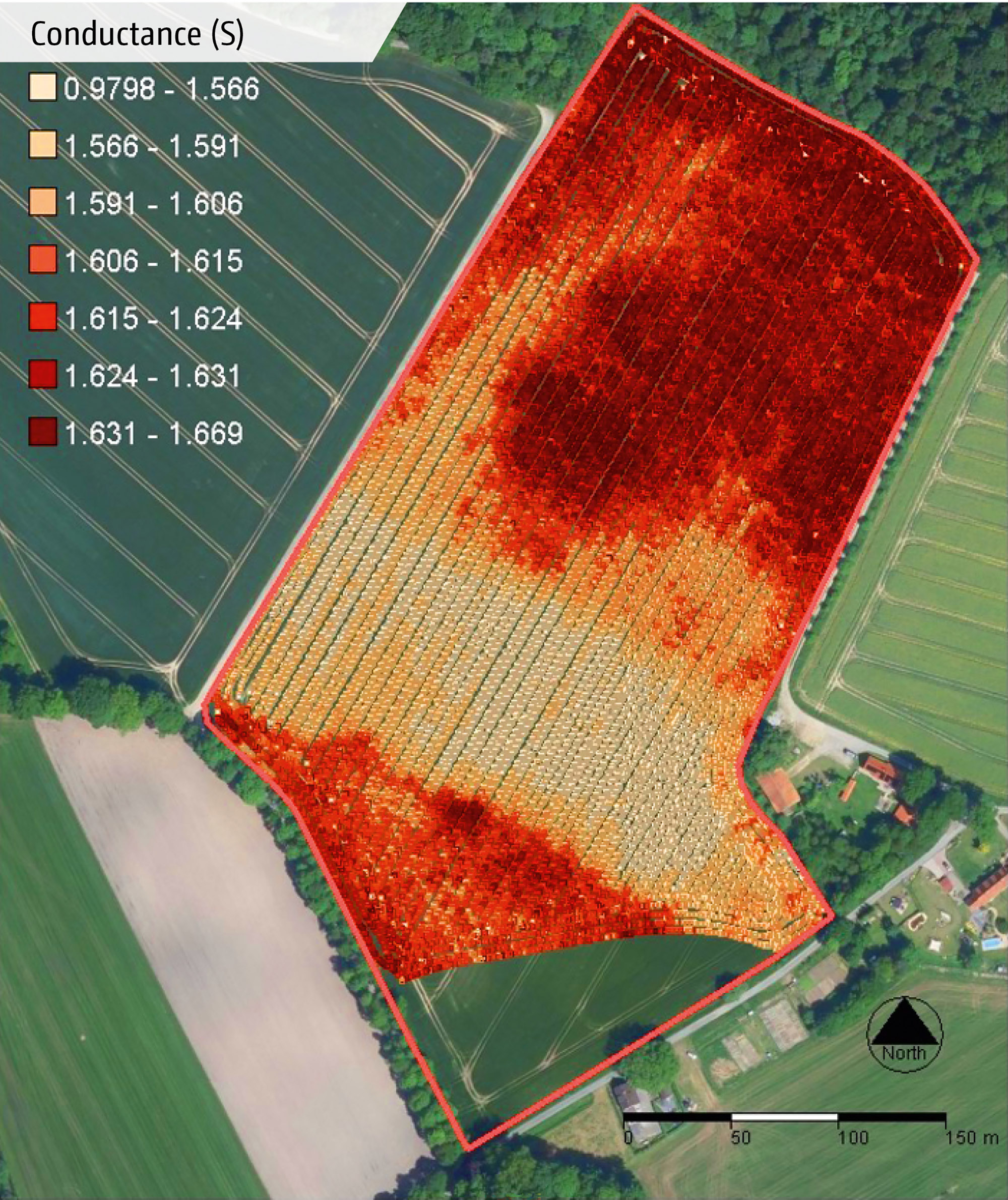
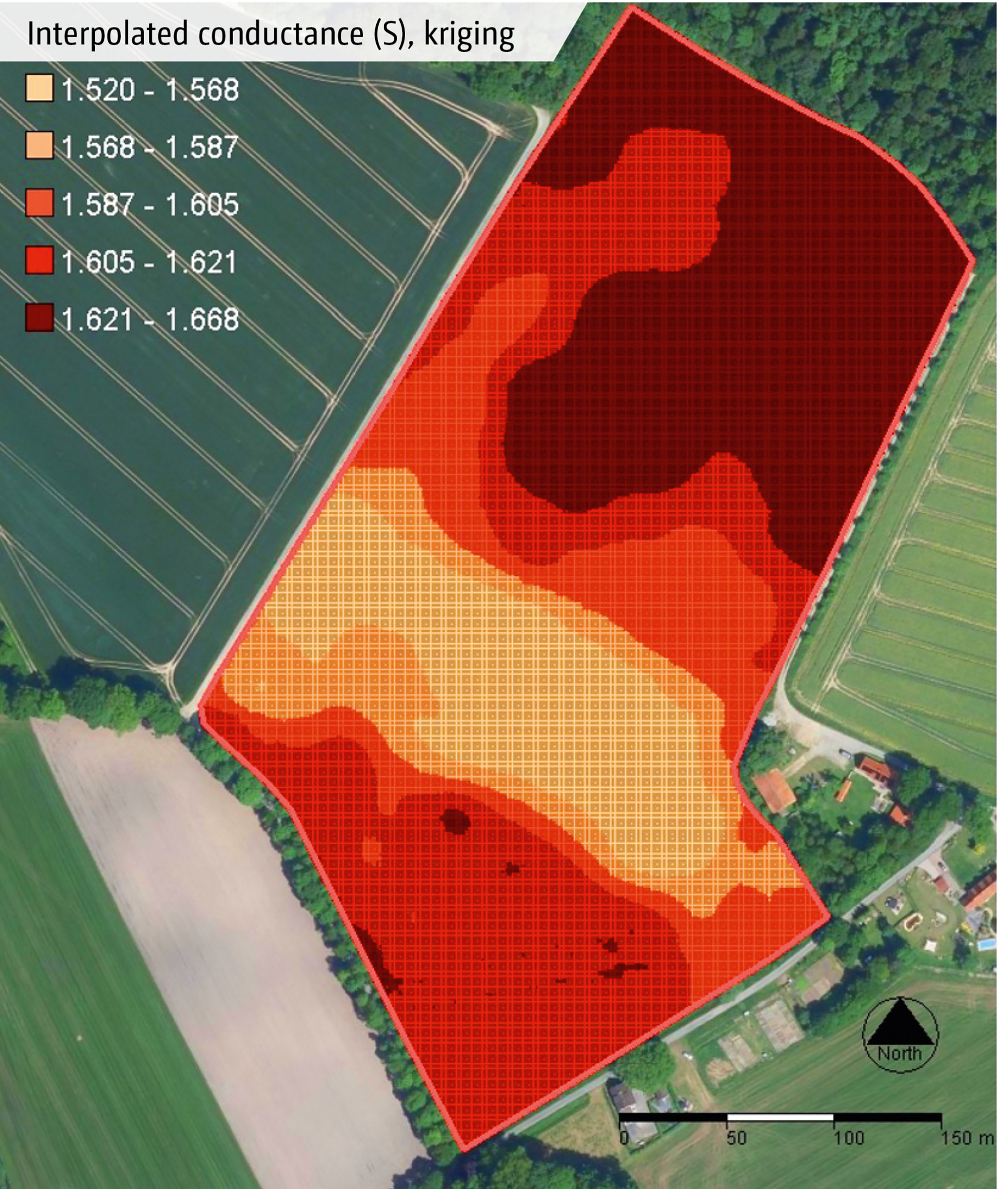
After processing the measured data and kriging (interpolation of the conductivity values), interpolated values of the electrical conductivity (EC values) are obtained, classified according to the Jenks method.
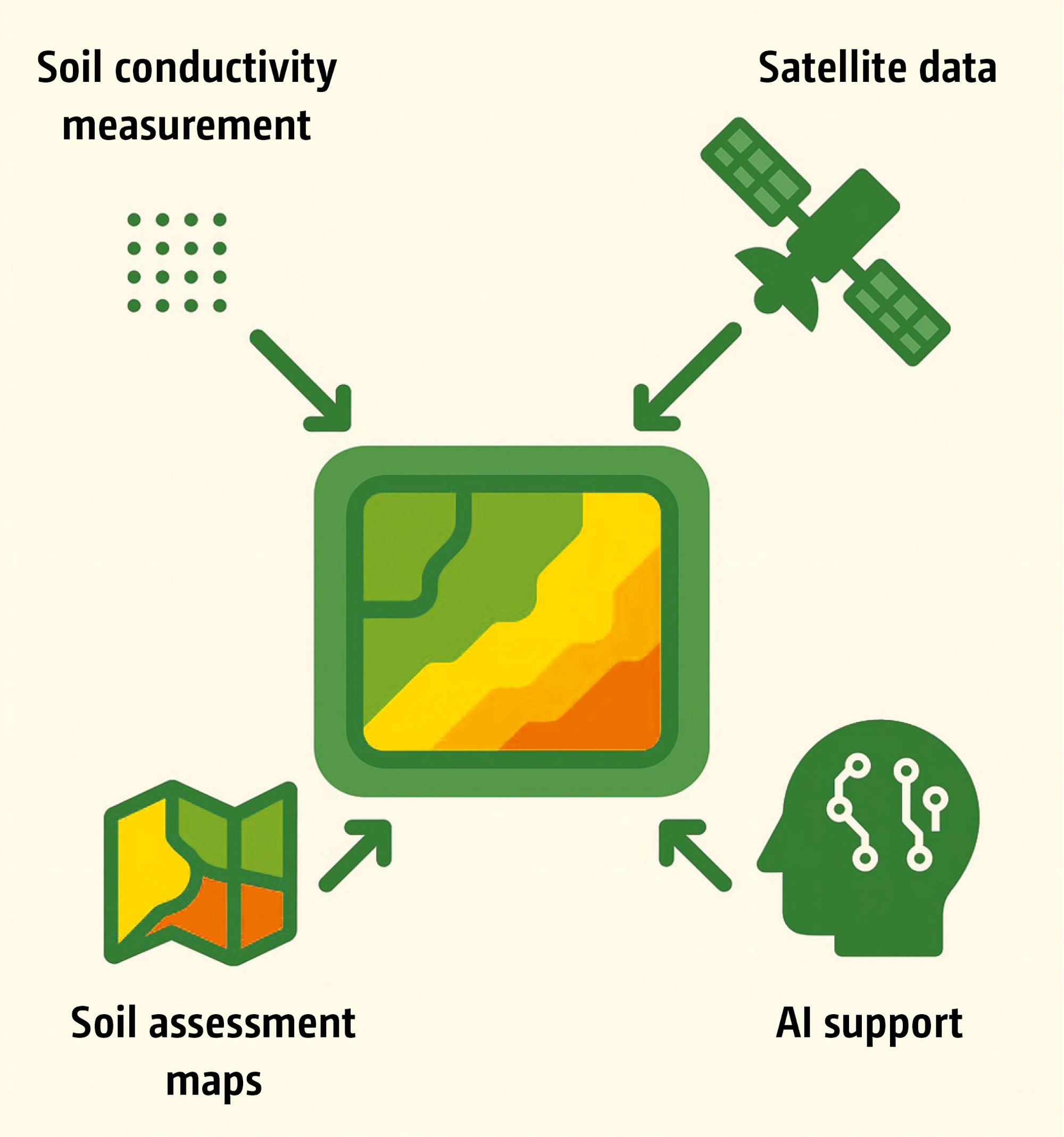
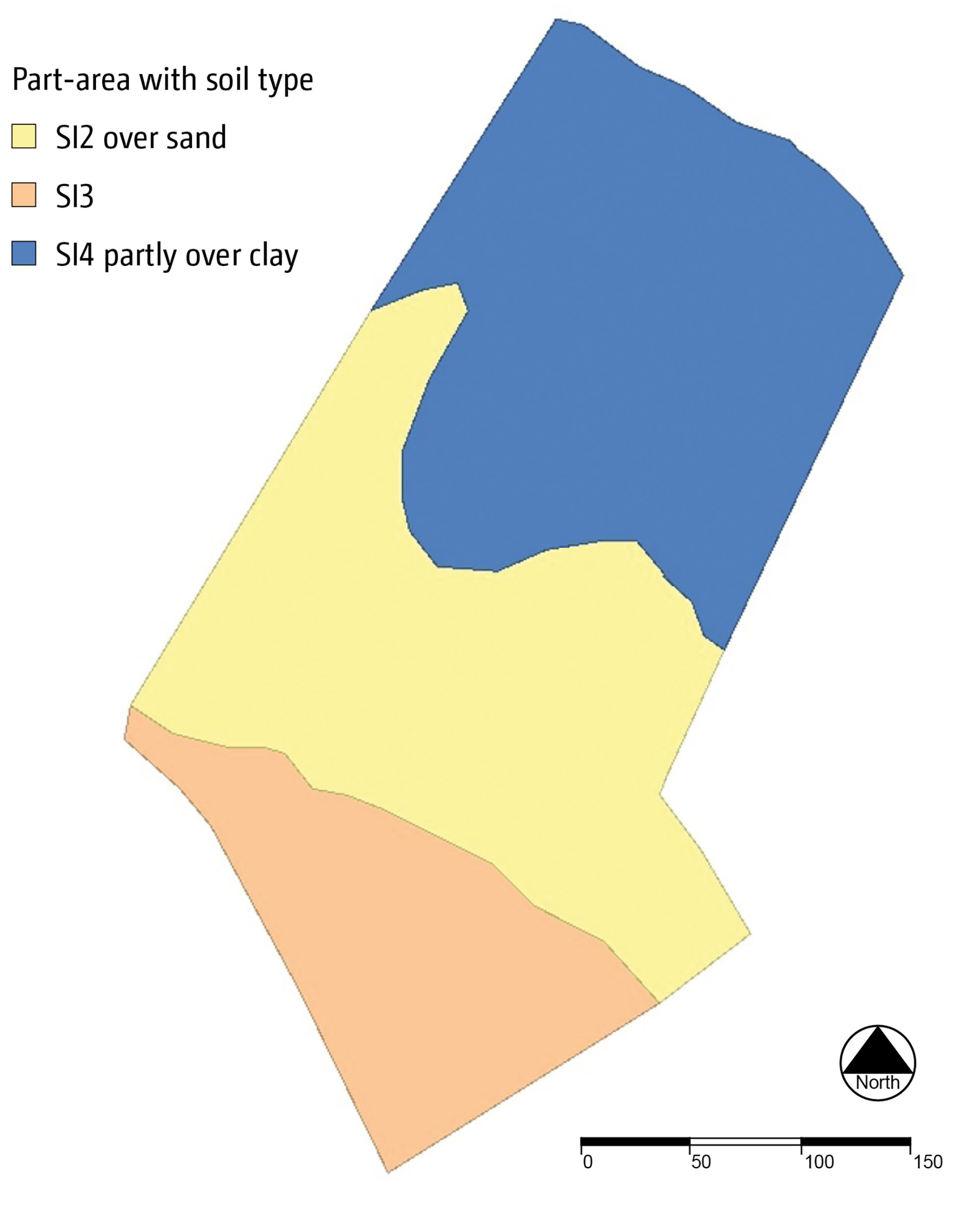
In the subsequent step, data is merged from the interpolated conductivity values, satellite data and soil estimate data from the respective agricultural offices.
This fusion creates the end product of SoilDetect, namely a site-specific soil map.
This enables optimisation of the pH value, fertilisation, sowing and, if necessary, adapted soil tillage on a part-area basis. Part-area, site-specific management has a positive effect on material flow, it promotes the targeted use of resources and may reduce the use of resources on agricultural land. The system allows decentralised use in all agricultural regions of the world.
SoilDetect can be integrated into all cultivators, provided that they are ISOBUS-equipped.
The intelligent connection and networking of implements using the cloud-based data platform AmaConnect opens up new possibilities. This lays the foundation for smart functions focusing on decision-making support, automation, process monitoring and quality assurance.
Expert knowledge is not required to collect data and transmit it to specialists worldwide via AmaConnect to generate yield potential maps. Real-time data, sensor systems and digital assistance systems create more transparency and efficiency in use.
As a result of this data, a high-resolution soil map is made available to the farmer as a basis for decision-making for part-area, site-specific arable farming with the aim of applying resources in a needs-based and targeted manner. This is how AMAZONE equipment becomes the digital partner for the operational challenges of tomorrow.
Downstream processes that influence growth conditions and water availability can be optimised using SoilDetect.
- SoilDetect is a system for measuring soil conductivity during the tillage operation
- SoilDetect combines AutoTill sensor systems and 4-point geo-electric measurement via the cultivator tines to determine the conductivity of the soil
- A high-resolution soil map is created from the fusion of data from sensor systems, satellite images (NDVI) and soil assessments with the support of artificial intelligence
- The soil maps generated allow part-area, site-specific cultivation with efficient use of inputs
- SoilDetect also serves to optimise downstream processes, such as improvement in growing conditions and water availability
- With SoilDetect, AMAZONE machinery becomes your intelligent partner on the farm
Gallery
